Message: NOAA-NWS-ALERTS-FL125D0FA99394.TropicalStormWarning.125D0FAAD18CFL
.JAXTCVJAX.3889fbd22ddb53ad5e8b246f47ff038e from w-nws.webmaster@noaa.gov
Sent: 23:01 EDT on 09-03-2019
Effective: 23:01 EDT on 09-03-2019
Expires: until further notice
[The above portion of this alert was intentionally included by Ocala Post]
As of 23:01 (11:01 p.m.) a tropical storm warning remained in effect for the following areas:
- Lynne
- Moss Bluff
The National Oceanic and Atmospheric Administration (NOAA) and the National Weather Service (NWS) out of Jacksonville, stated that the winds have decreased from previous assessments. The latest local forecast shows peak winds at 10 to 20 mph, with gusts to 45 mph.
At this time, the sustained wind should remain less than tropical storm force with gusty conditions.
The NOAA and NWS reported, “Little to no preparations [are] needed to guard against tropical winds at this time. Ensure emergency readiness should the forecast change.”
Latest rain forecast
Peak Rainfall Amounts will be an additional 1-3 inches, with locally higher amounts. There is a potential for localized flooding, which has remained a steady threat. Emergency plans should include the potential for localized flooding from heavy rain. Consider protective actions if you are in an area vulnerable to flooding. Heed any flood watches and warnings.
Rivers and tributaries may quickly rise with swifter currents. Small streams, creeks, canals, and ditches may become swollen and overflow in spots. Floodwaters can enter a few structures, especially in usually vulnerable spots. A few places where rapid ponding of water occurs at underpasses, low-lying spots, and poor drainage areas. Several storm drains and retention ponds become near-full and begin to overflow. Some brief road and bridge closures.
Local tornado warning/watch
The situation is unfavorable for tornadoes as tornadoes are not expected. Showers and thunderstorms
with gusty winds may still occur. Watch your local weather, or listen to your NOAA/NWS approved weather radio for changes in the forecast.
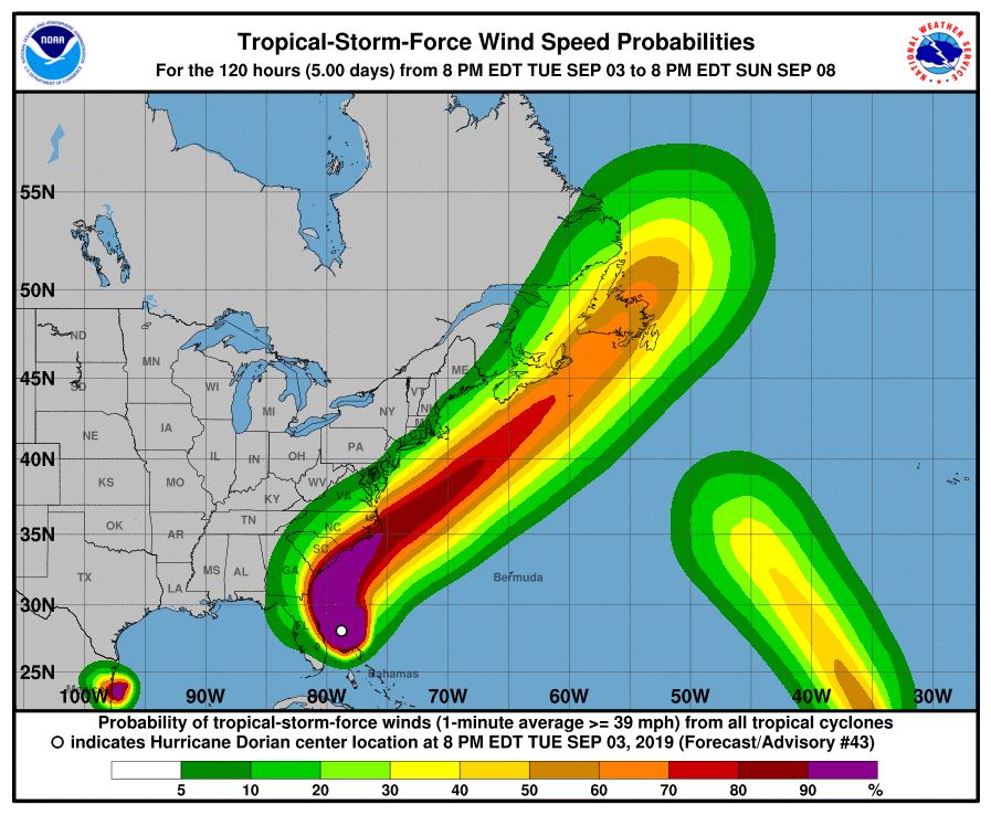
When reading the graphics, pay close attention to the color codings for the area over Marion County.
Stay tuned to your local weather channel for changes in the forecast.

